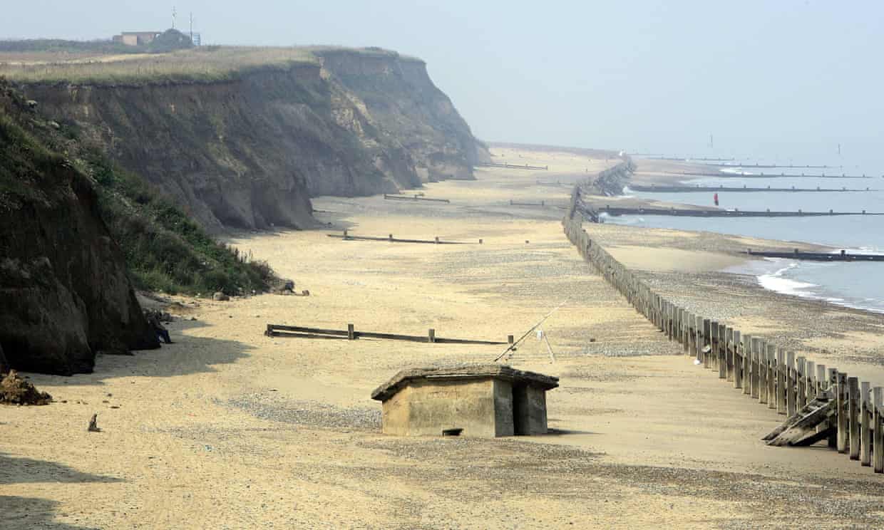
Sites at risk include second world war pillboxes like this one at Happisburgh, North Norfolk, which used to be on top of the cliffs. Photograph: Christopher Furlong/Getty Images
Project will evaluate 5,600 miles of English coastline, where some 70,000 archaeological sites are threatened by changing sea levels or coastal erosion
A small army of volunteers, backed by drone technology, is being recruited to record and monitor the longest archaeological site in Britain: 5,600 miles of English coastline and tidal foreshore containing some 70,000 sites at risk of being destroyed by changing sea levels or coastal erosion.
The drones are being sent in as the safest and quickest way to survey large sites where there is little more than an hour of working time between tides.
Excavation and recording work began this week at the Isle of Sheppey, Kent, where drone-mounted cameras have revealed a gaping hole in the flank of an early 20th-century vessel, the Hans Egede, a three-masted grain ship built in Denmark in 1922. After surviving a fire at sea and spending years moored in the Medway and being used as storage, it sank while being towed in the 60s. It was finally beached off Cliffe, where it has been a spooky landmark. It suffered further serious damage in the winter storms of 2013.
Read the rest of this article...
No comments:
Post a Comment