Wednesday 2 December 2020

Melting ice patch in Norway reveals large collection of ancient arrows


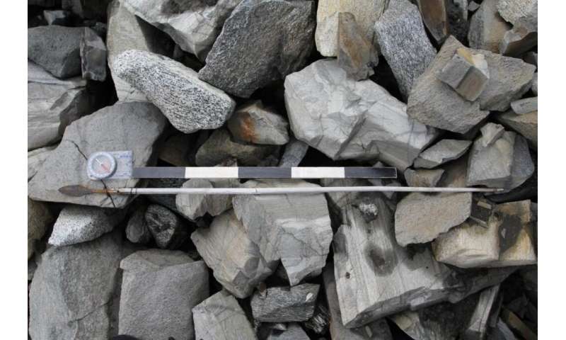
An arrow from c. AD 700 as it was found lying on the stones in the scree, close to the melting ice. Credit: Innlandet Fylkeskommune

A team of researchers affiliated with a host of institutions in Norway and one in the U.K., has unveiled their findings after collecting and studying a very large number of ancient arrows they found near a melting ice patch in Norway's Jotunheimen Mountains. In their paper published in the journal The Holocene, the group describes how they kept their research secret to avoid the possibility of others contaminating the site and what they have learned about the arrows thus far.

Back in 2006, archeologist Reidar Marstein found an ancient shoe lying near a melting ice patch (which subsequent recent has shown to have formed approximately around 5600BC) in the Jotunheimen Mountains. The shoe was initially believed to have been from the Viking era, but subsequent study showed it to be approximately 3,300 years old.

Read the rest of this article...

Study Rewrites History of Ancient Land Bridge Between Britain and Europe

 New research suggests that climate change, not a tsunami, doomed the now-submerged territory of Doggerland


As recently as 20,000 years ago—not long in geological terms—Britain was not, in fact, an island. Instead, the terrain that became the British Isles was linked to mainland Europe by Doggerland, a tract of now-submerged territory where early Mesolithic hunter-gatherers lived, settled and traveled.

Doggerland gradually shrank as rising sea levels flooded the area. Then, around 6150 B.C., disaster struck: The Storegga Slide, a submarine landslide off the coast of Norway, triggered a tsunami in the North Sea, flooding the British coastline and likely killing thousands of humans based in coastal settlements, reports Esther Addley for the Guardian.

Historians have long assumed that this tsunami was the deciding factor that finally separated Britain from mainland Europe. But new archaeological research published in the December issue of Antiquity argues that Doggerland may have actually survived as an archipelago of islands for several more centuries.

Co-author Vincent Gaffney, an archaeologist at the University of Bradford, has spent the past 15 years surveying Doggerland’s underwater remains as part of the Europe’s Lost Frontiers project. Using seismic mapping, computer simulations and other techniques, Gaffney and his colleagues have successfully mapped the territory’s marshes, rivers and other geographical features.

Read the rest of this article...