Tuesday 28 April 2020

Long-forgotten Viking mountain pass found in Norway following glacier melt

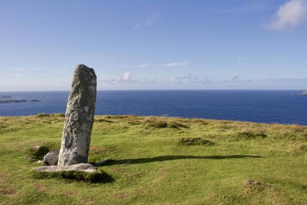
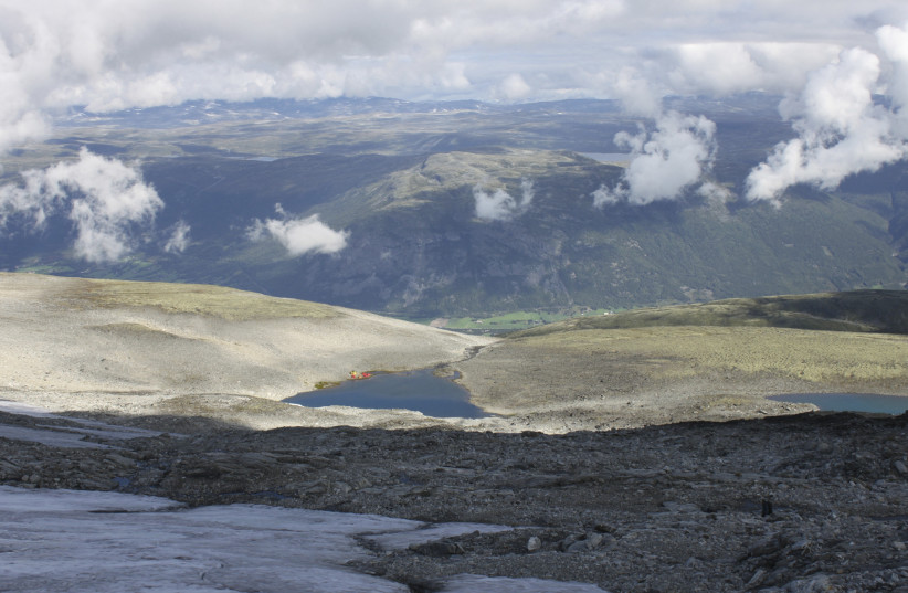
General view over valley in mountains of south Norway from beside Lendbreen glacier is seen in this undated handout picture
(photo credit: REUTERS)

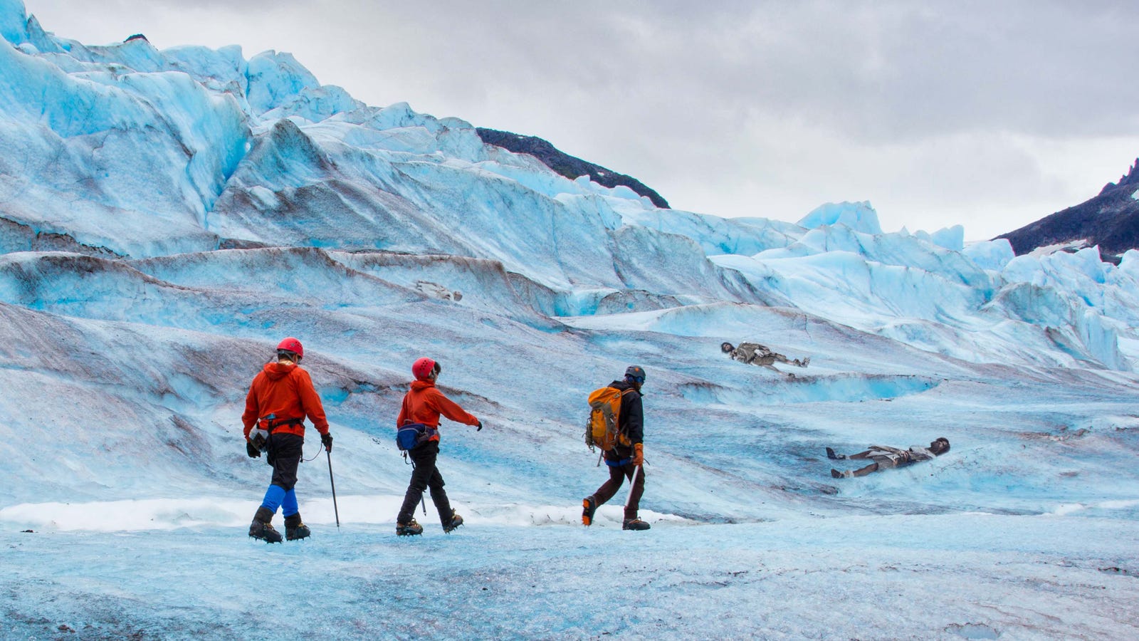
Due to global warming, high-elevation ice patches and glaciers have recently yielded a myriad of historical finds for archaeologists to discover.

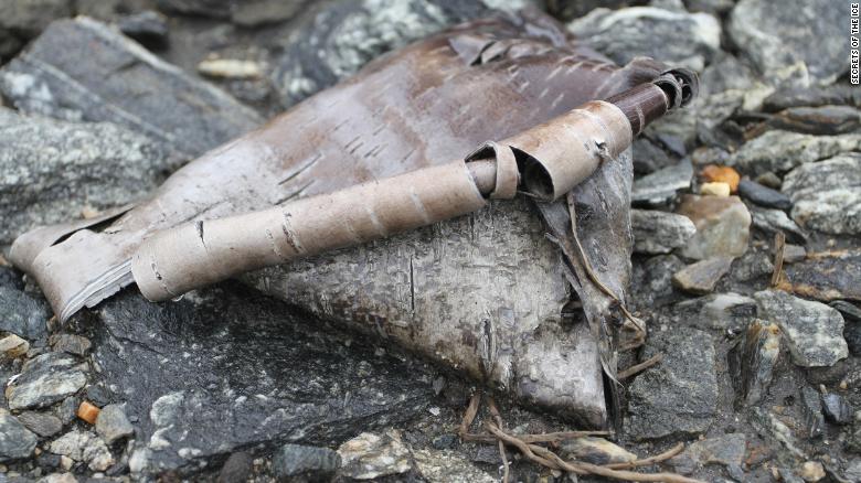
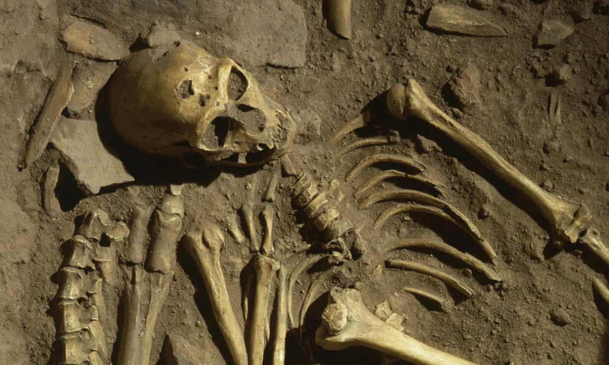
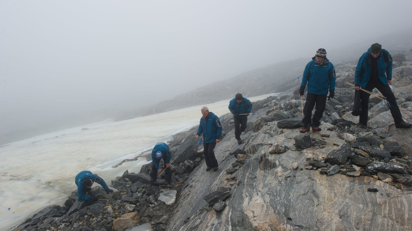
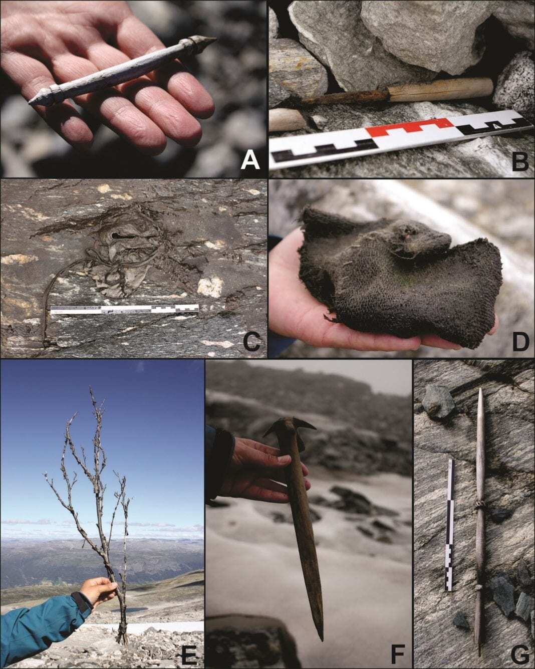
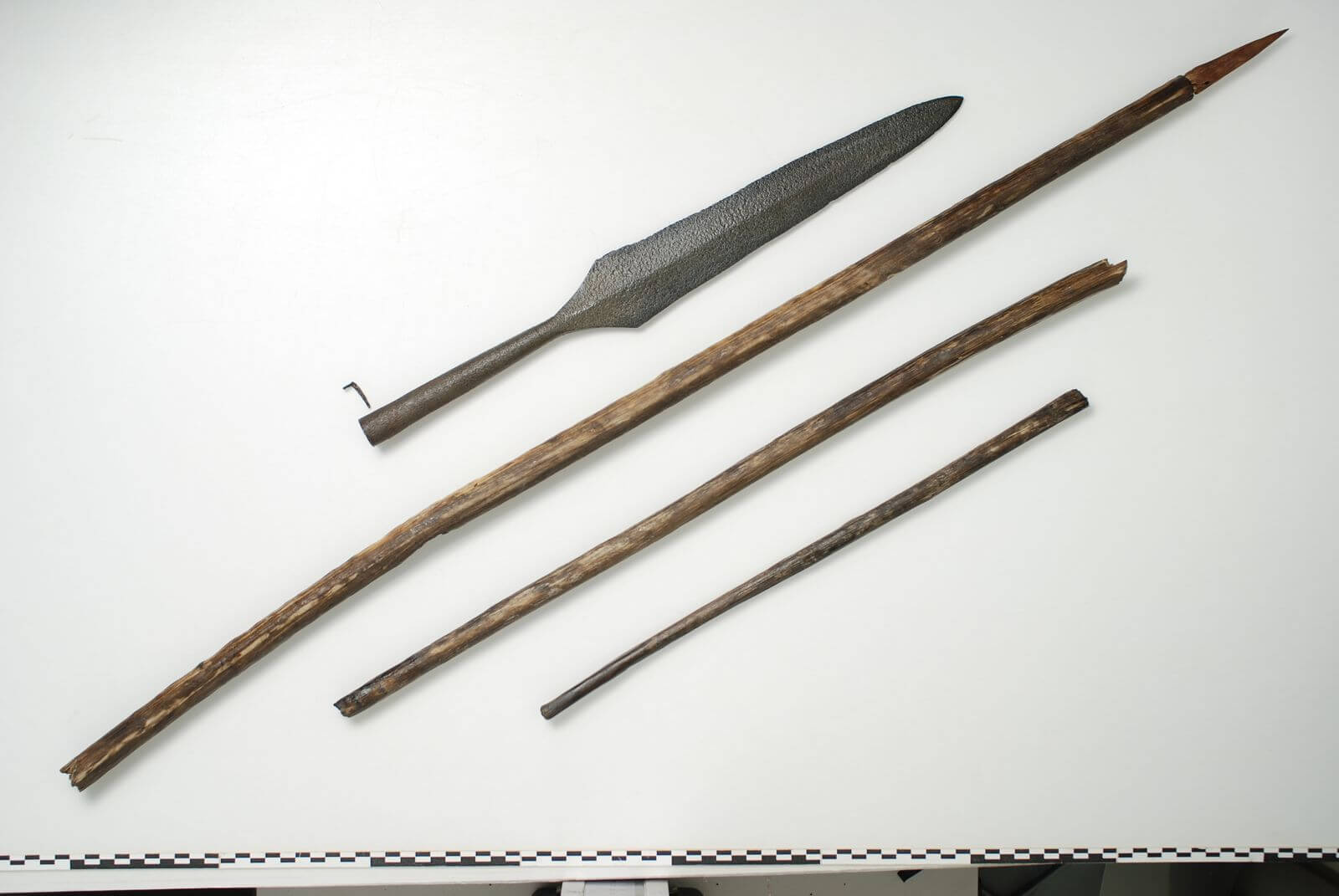
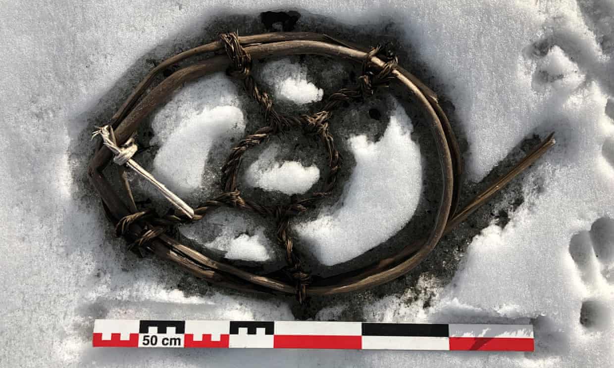
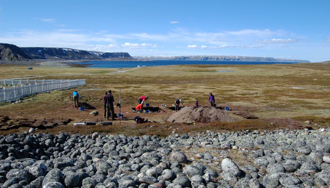
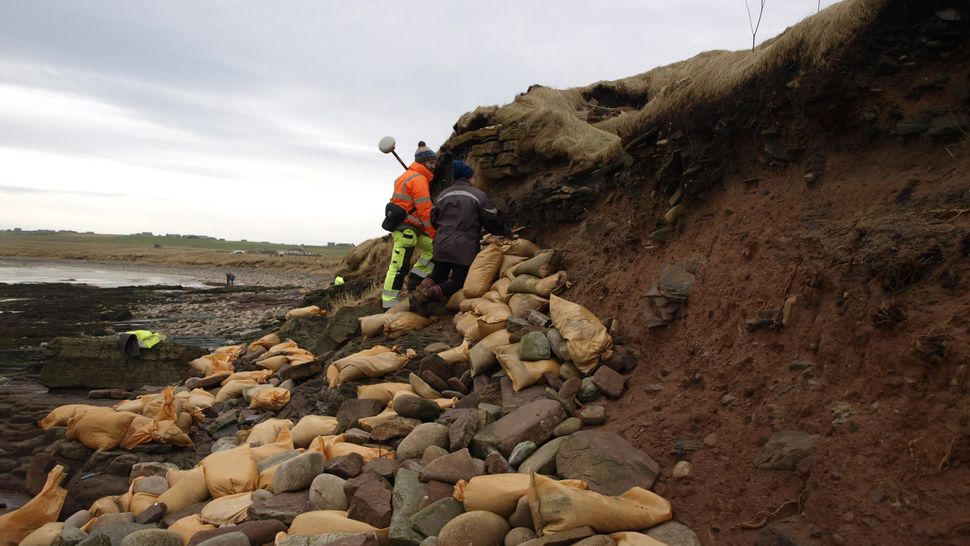
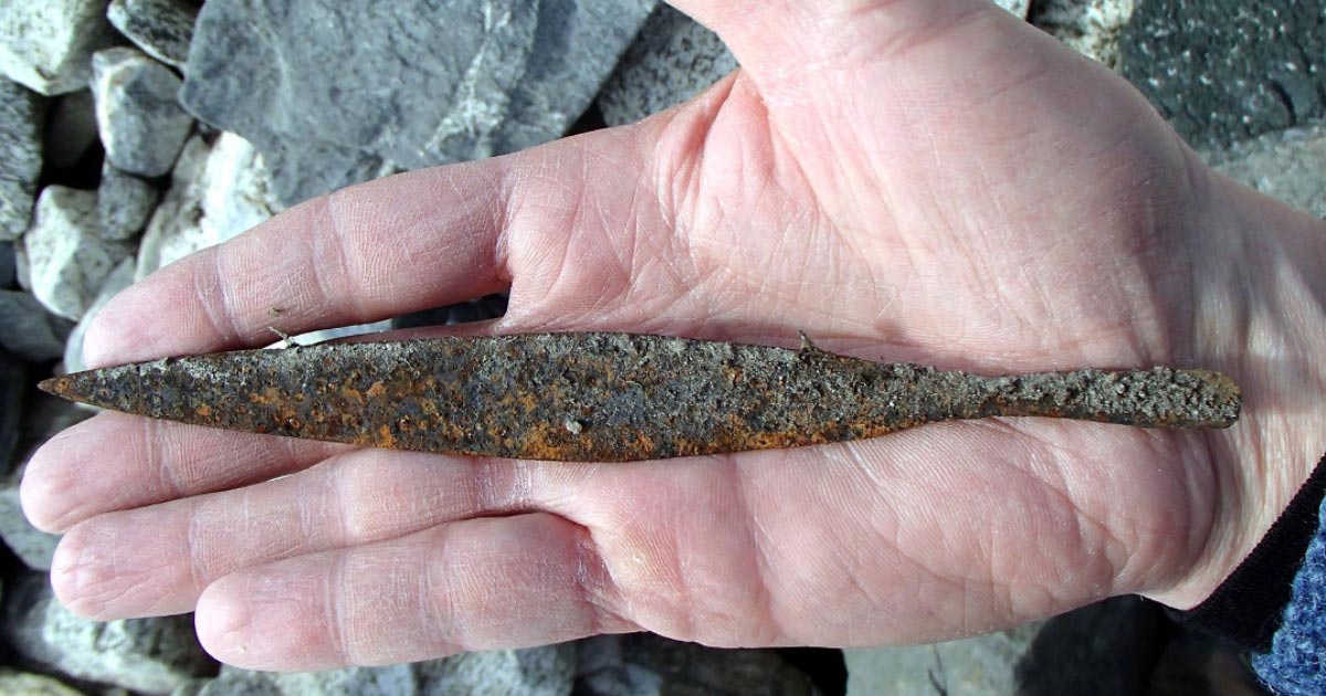
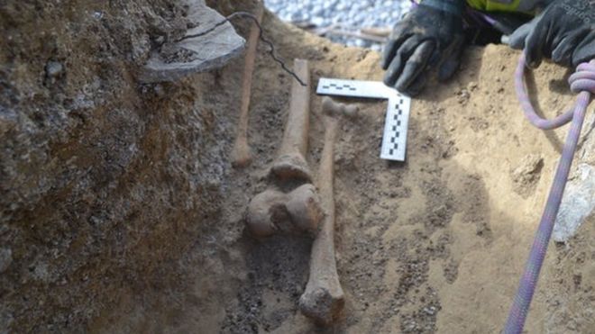
Archaeologists have uncovered a heavily traversed glacial mountain pass in Lendbreen, Norway, utilized by travelers throughout the Viking Age, and littered with hundreds of artifacts presumed to have been used by the Vikings during that time period, according to a new study published by the Cambridge University Press on Wednesday.
Due to the warming global climate, high-elevation ice patches and glaciers have recently yielded a myriad of historical finds for archaeologists to happen upon as they finally gain access to these areas after the layers of ice once covering them have gradually melted away over time – and much faster recently.

Read the rest of this article...

Melting glaciers reveal lost mountain pass and artifacts used by Vikings


The retreat of melting glaciers has revealed a lost mountain pass in Norway -- complete with hundreds of Viking artifacts strewn along it, according to a new study.

Researchers first discovered the pass in 2011 and have been examining it, and the artifacts that have been revealed as more ice melts, ever since. Dating the objects helped them reconstruct the timeline of when this pass was used and its purpose.
The new study published this week in the journal Antiquity.
In recent years, climate change has caused mountain glaciers to melt away, revealing well-preserved markers from different periods in history beneath. This is what happened in Lendbreen, Norway.

Read the rest of this article...

Monday 27 April 2020

Could bringing Neanderthals back to life save the environment? The idea is not quite science fiction

A Neanderthal tomb burial near the village of La Chapelle-aux-Saints in France. Author James Bradley asks: what would it mean if the deep past were to come to life? 
Photograph: The Art Archive/Alamy

The climate emergency is unsettling our future, and erasing what we thought was certain about the past

In 2015, flooding exposed the frozen bodies of two cave lion cubs in the Yakutia region of Russia. Members of a species that vanished at the end of the last Ice Age, the pair were buried approximately 12,000 years ago when the roof of their den collapsed and trapped them in the frozen ground. In photos, their faces are so well-preserved one might almost believe they are only sleeping.

Yet despite their unusually perfect condition, the cubs are not the only such relics to have appeared in recent years. Throughout the Arctic and subarctic, animals and artefacts buried for thousands of years are reappearing, liberated from their frozen graves by the rapid warming in the region. In the Alps and elsewhere, bodies of people lost for decades in the mountains are emerging from the ice as glaciers melt. In Australia, towns submerged for generations are resurfacing as dam levels fall due to drought and heat.

As British author Robert Macfarlane has observed, these uncanny emergences or “Anthropocene unburials” are part of a larger process of unsettlement and unhinging. As human time and geological time collapse into one another, the deep past is erupting into the present all around us with terrifying and uncanny consequences. What was fixed is now in flux, what was settled is being swept away faster than we can save it. Nor is it just the past that has become unstable. The climate emergency is unsettling our future as well, erasing what we thought was certain, what we thought we knew.

Read the rest of this article...

Sunday 26 April 2020

Diverse livelihoods helped resilient Iron Age Levanluhta people survive a climate disaster

Levanluhta is among the most unique archaeological sites, even on a global scale. Bones belonging to nearly a hundred individuals who died in the Iron Age have been discovered in the middle of the Southern Ostrobothnia plains in western Finland since the 17th century. Today, three springs and their ferrous red water serve as reminders of this ancient burial site [Credit: Anna Wessman]

A multidisciplinary research group coordinated by the University of Helsinki dated the bones of dozens of Iron Age residents of the Levanluhta site in Finland, and studied the carbon and nitrogen stable isotope ratios. The results provide an overview of the dietary habits based on terrestrial, marine and freshwater ecosystems, as well as of sources of livelihoods throughout the Levanluhta era.

Ever since the 17th century, human bones have been emerging from the spring-containing lake burial site at Levanluhta in Southern Ostrobothnia, western Finland. The secrets of these Iron Age remains are now beginning to be revealed through measuring isotopes of atomic nuclei. A recently published study offers an overview of a diverse community that relied on an extremely broad range of livelihoods, which matches well with the understanding provided by archaeological discoveries.

The carbon and nitrogen in human food end up in the skeletal system and soft tissues as building blocks for the human body. There are three isotopes of carbon and two of nitrogen, and information pertaining to past events is recorded in the contents and ratios of these isotopes.

Read the rest of this article...

Thursday 23 April 2020

The 7 mysterious ‘lost towns’ of East Anglia

The remains of Dunwich's Greyfriars Picture: Phil Morley

Discover the settlements that time forgot - and then remembered again thanks to the power of archaeology

It’s well-known that the region of East Anglia is steeped in a deep and fascinating history. Home to an array of ancient ruins and deserted settlements, the area has been graced by the footsteps of many – including the Romans, Anglo-Saxons and the Iceni tribe.

We spoke to Dr Andrew Rogerson, former senior archaeologist at Norfolk Historic Environment Service, who helped us delve deeper into some of the towns and villages that have been ‘lost’ to time – and brought back to life once again thanks to the wonders of archaeological exploration. Dr Rogerson said: “None of these places have been ‘rediscovered’ – they have never really gone away. Until the 1950s, very little attention was paid to the archaeology of medieval, as opposed to prehistoric and Roman settlements.”

Read the rest of this article...

Wednesday 22 April 2020

Melting Ice Exposes Mountain Pass Used by Vikings, Including Ancient Dog and Leash

Glacial archaeologists performing fieldwork at Lendbreen, Norway.
Image: L. Pilø et al., 2020/Antiquity

Archaeologists in central Norway have uncovered evidence of a heavily traveled mountain passageway that was used during the Viking Age. Hundreds of beautifully preserved items were found atop a melting glacier, in a discovery that was, sadly, made possible by global warming.

New research published today in Antiquity describes a forgotten mountain pass at Lendbreen, Norway, that was in use from the Iron Age through to the European medieval period.

Located on Lomseggen Ridge, the passageway is absolutely littered with well-preserved artifacts, including mittens, shoes, horse snowshoes, bits of sleds, and even the remains of a dog still attached to its collar and leash. Radiocarbon dating of these artifacts is painting a picture of how and when this pivotal mountain pass was used, and its importance to both local and outside communities.

Read the rest of this article...

Melting ice reveals lost viking artefacts on mountain pass

Image Credit : Antiquity Journal

Climate change is leading to the retreat of mountain glaciers.
In Norway, hundreds of rare archaeological finds have been revealed by melting ice in a lost mountain pass at Lendbreen in Innlandet County.

The finds tell a remarkable story of high-altitude travel in the Roman Iron Age and the Viking Age.

“A lost mountain pass melting out of the ice is a dream discovery for us glacial archaeologists,” says Lars Pilo, first author of the study and co-director for the Glacier Archaeology Program.

“In such passes, travellers lost many artefacts that became frozen in time by the ice. These incredibly well-preserved artefacts of organic materials have great historical value.”

Read the rest of this article...

The Hunt for the Lost Mountain Pass

Viking Age spear, originally found in one piece in front of the Lendbreen ice patch. 
Photo: Vegard Vike, Museum of Cultural History.

Global warming is leading to the retreat of mountain glaciers. Surprisingly, this has created a boon for archaeology. Incredibly well preserved and rare artifacts have emerged from melting glaciers and ice patches in North America, the Alps and Scandinavia. A new archaeological field has opened up – glacial archaeology. The archaeological finds from the ice show that humans have utilized the high mountains more intensely than was previously known – for hunting, transhumance and traveling. New important discoveries are made each year, as the ice continues to melt back.

As glacial archaeologists, our dream discovery is a site where an ancient high mountain trail crossed non-moving ice. On such sites, past travelers left behind lots of artifacts, frozen in time by the ice. These artifacts can tell us when people travelled, when travel was at its most intense, why people travelled across the mountains and even who the travelers were. This information has great historical value.

Read the rest of this article...

'Spectacular' artefacts found as Norway ice-patch melts

A horse snowshoe found during 2019 fieldwork at Lendbreen. 
Photograph: Espen Finstad/secretsoftheice.com

Discoveries exposed by retreating ice include snowshoe for horses and bronze age ski

The retreat of a Norwegian mountain ice patch, which is melting because of climate change, has revealed a lost Viking-era mountain pass scattered with “spectacular” and perfectly preserved artefacts that had been dropped by the side of the road.

The pass, at Lendbreen in Norway’s mountainous central region, first came to the attention of local archaeologists in 2011, after a woollen tunic was discovered that was later dated to the third or fourth century AD. The ice has retreated significantly in the years since, exposing a wealth of artefacts including knitted mittens, leather shoes and arrows still with their feathers attached.

Though carbon dating of the finds reveals the pass was in use by farmers and travellers for a thousand years, from the Nordic iron age, around AD200-300, until it fell out of use after the Black Death in the 14th century, the bulk of the finds date from the period around AD1000, during the Viking era, when trade and mobility in the region were at their zenith.

Read the rest of this article...

Seafood full of poison in the Stone Age, because of climate change

The excavation and the view towards the west in Varanger. During the settlement, the shoreline was approximately 10 meters below the edge of the excavation. The land has risen a lot since the settlement was in use, some 12 meters. (Photo: Hans Peter Blankholm)

Large amounts of toxic heavy metals such as cadmium and lead made cod and Greenland seals into harmful food in Northern Norway during the Younger Stone Age. Constantly rising sea temperatures and sea-level rise due to climate change can cause seafood to become equally unhealthy in the future.

This is what archaeology researchers are warning about in a recent study published in the journal Quaternary International.

"The discovery of so much toxic heavy metals in the seafood was very surprising, and we found very high values", says professor of archaeology at UiT The Arctic University of Norway, Hans Peter Blankholm.

Read the rest of this article...

Overwhelmed Archaeologists Struggling To Keep Pace With Glut Of Early Humans Thawed Out By Climate Change


OXFORD, ENGLAND—Noting that the steady rise in global temperatures was beginning to have a significant impact on their work, anthropologists at Oxford University told reporters Tuesday that they were struggling to keep up with the abundance of early human remains being thawed out due to climate change. “It seems like every other day a hunter in North Canada or some unsuspecting hikers in Siberia are stumbling across the perfectly preserved remains of a 2,000-year-old human ancestor emerging from melting glaciers or receding permafrost; we can barely keep up,” said lead researcher Adam Daly, adding that as climate change has become more severe, his team has had to take drastic measures to fast-track some of their processes, such as performing CT scans on more than one mummified carcass at once and skipping hair analysis altogether.

Read the rest of this article...

The Celtic Ogham: An Ancient Tree Alphabet that May Disappear Before Showing its Roots

An ancient ogham stone on the top of Dunmore Head on the Dingle Peninsula in County Kerry, Ireland. ( Cynthia /Adobe Stock)

In secluded fields, on the walls of churches, and beneath construction sites, stones have been found with intricate markings that rise from the lower left up to the center and then down to the lower right. This is the ancient Celtic Tree Alphabet known as Ogham (pronounced owam). Archaeological linguists have managed to translate the symbols, yet no one knows for certain how or why this language came into existence. Efforts are being made to preserve the relics; however, the stones are weathering and crumbling at an alarming rate.

Attempts to Save the Unique Ogham Inscriptions
There are roughly 400 stones known to contain Ogham markings, 360 of which are in Ireland. The rest have been discovered scattered across Wales, Scotland, England, and the Isle of Man. The oldest relic is believed to date back to the 4th century AD, but one must assume that earlier examples existed on perishable mediums, such as wood, possibly as far back as the 1st century AD.

For the most part, the messages contain names of people and places, perhaps to demarcate boundaries and property. These old, weathered rocks are covered with lines and slashes, cut directly into the stone. Before the realization that Ogham was a distinct language, many believed the cuts to be merely decorative.

Read the rest of this article...

Scottish storms unearth 1,500-year-old Viking-era cemetery

Archaeologists and volunteers are working to preserve human bones exposed by recent storms in an ancient cemetery above a beach on the Orkney Islands.
(Image: © ORCA Archaeology)

Powerful storms on the Orkney Islands in the far north of Scotland recently exposed ancient human bones in a Pictish and Viking cemetery dating to almost 1,500 years ago. Volunteers are piling sandbags and clay to protect the remains and limit the damage to the ancient Newark Bay cemetery on Orkney's largest island. 

The cemetery traces its origins to the middle of the sixth century, when the Orkney Islands were inhabited by native Pictish people, akin to the Picts who inhabited most of what is now Scotland.

It was used for almost a thousand years, and many of the burials from the ninth through the 15th centuries were Norsemen or Vikings who had taken over the Orkney Islands from the Picts. But waves raised by storms are eating away at the low cliff where the ancient cemetery lies, said Peter Higgins of the Orkney Research Center for Archaeology (ORCA), part of the Archaeology Institute of the University of the Highlands and Islands.

Read the rest of this article...

Huge 1,500-Year-Old Arrowhead Released From Melting Glacier


Archaeologists in Norway have uncovered a 1,500-year-old iron arrowhead in a melting glacier.

The team of investigators inspecting Jotunheimen, a massive melting Norwegian glacier, have so far found over 2000 relics and now an arrowhead dating back to the Germanic Iron Age. Measuring seven inches long and weighing little over an ounce ‘ Climate Change ’ is being held responsible for revealing the ancient Viking's missed shot that had been embedded in a glacier for 1,500 years.

An Ancient Landscape of Unspeakable Beauty
The ancient Germanic Iron Age arrowhead was forged in iron and was discovered with its arrow shaft, and even a feather from its flight, locked in a glacier in southern Norway. The team of scientists noted that climate change has made its way to the Jotunheimen glacier and the warmer air temperature is causing the ice to melt which in turn freed the ancient artifacts.

Read the rest of this article...

Tuesday 21 April 2020

Coastal erosion reveals 'shipwreck' skeletons on Glamorgan Heritage Coast

Archaeologists had to use safety ropes to carry out the excavations 
CARDIFF UNIVERSITY

Skeletal remains of at least six people, thought to be shipwreck victims from hundreds of years ago, have been revealed by coastal erosion.

Experts have recovered some of their bones from a cliff edge at Cwm Nash on the Glamorgan Heritage Coast.

Other bones have already been lost to the sea, according to Prof Jacqui Mulville from Cardiff University.

The remains of people recovered from the site previously have been found to date from the 16th Century.

Read the rest of this article...


Pompeii among 37 World Heritage Sites at risk from flooding and erosion as sea levels rise

Sea levels rises and storm surges will cause flooding as the climate warms, scientists have warned  CREDIT:  DAVID SOANES PHOTOGRAPHY GETTY 

They have already been wiped out once by the devastating eruption of Vesuvius in 79AD.

But now the Roman ruins of Pompeii and Herculaneum could be lost through flooding and erosion caused by climate change, a major study has found.

The ancient towns are among dozens of World Heritage sites at risk from sea-level rise in the Mediterranean as the climate warms, researchers at the University of Kiel, in Germany, have warned.

Other sites at risk include the historic sites in Istanbul and Dubrovnik, as well as the kasbah at Algiers, the Medieval city of Rhodes and the archaeological site of Carthage.

Read the rest of this article...


Historic British landscapes under severe threat from climate crisis

The Dysynni Valley in Wales which is home to the remains of post-medieval agricultural activity that include drystone walls. Drystone walls are a key element of the historic character of the landscape in the Dysynni valley, but also across the rest of Snowdonia, the Lake District, and the Peak District. Changing weather conditions, such as warmer temperatures and longer growing seasons, means that the vegetation type in this area may change, shrubs or trees may grow over the remains, obscuring them and altering the historic character of the landscape

Some of Britain’s most loved historical landscapes such as the Lake District, Snowdonia and the Orkney Islands are at risk of being severely damaged and changed forever by the effects of climate change, according to an archaeologist from the University of Sheffield.

Research by Isabel Cook, a PhD student from the University’s Department of Archaeology, is adding to the growing evidence that historic landscapes across the UK have already been affected by climate change impacts, such as sea-level rise, coastal erosion and flooding.

Among the historic landscapes affected is the Dysynni Valley in Wales, which is home to military remains dating back to the Second World War. Isabel’s research has found that the area is at risk from sea-level rise and flooding, with the remains under severe threat of erosion.

Read the rest of this article...


Crumbling coast: saving Scotland’s heritage


Archaeologists at St Andrews have brought local communities together to find solutions for saving some of Scotland’s most endangered historical sites from coastal erosion.

One archaeological research team at the University of St Andrews has developed an extensive survey of Scotland’s coastline, recording not only threats to historical sites, but also the effects of climate change. Through their work, they have empowered local communities to take action to record and preserve historical sites which are threatened by coastal erosion and weather.

The sea poses one of the greatest natural threats to cultural heritage sites located on the coast. It is estimated that £400 million worth of property and infrastructure around Scotland's coastline is at risk due to the effects of erosion. 

Monitoring and taking action to protect Scotland’s coastal heritage sites is an extremely difficult task. For one thing, the length of the coastline (18,670km) makes it difficult to find the resource to monitor coastal changes, especially in difficult-to-reach locations. In addition, there are well over 12,000 sites to oversee – no small task for Scotland’s archaeologists.

Read the rest of this article...


Slipping Away: Coastal Erosion and Archaeology

The human footprints exposed on the beach at Happisburgh in Norfolk in 2013. They are thought to be between 800,000 and 1 million years old. © Simon Parfitt.

Erosion of our shores is nothing new. Though the rate of erosion may be increasing due to climate change, England’s coastline has always been on the move.

Global sea levels have risen by some 110-130m since the melting of the vast ice sheets that covered the world’s continents 22,000 years ago (the high point of the last Ice Age). Until some 8500 years ago Britain wasn’t even an island, and people could walk between East Anglia and the Netherlands across so-called ‘Doggerland’ (now inundated by the North Sea).

Erosion is justifiably seen as a threat to people’s homes and livelihoods as well as to the nation’s historic fabric. But coastal erosion is also capable of uncovering buried archaeological gems before destroying them.

Marcus Jecock, Senior Investigator and Coastal Survey Lead at Historic England, takes us through 7 of the best archaeological discoveries recently revealed by, or presently at risk from coastal erosion:

Read the rest of this article...

Old Skegness lost to the sea could be hiding ancient treasures

Dr Caitlin Green's map of the Skegness area coastline as it would have looked in medieval times - before the old town of Skegness was swallowed by the sea. Inset: A gold Early Anglo-Saxon pendant recently unearthed in the resort..

Experts are hoping ancient artefacts washing up on Skegness beach will reveal the location of a mysterious submerged Roman town.

It has been known for some time that ‘old Skegness’ was swallowed by the sea in the 1500s following storms and floods - it now being located about half a-mile out to sea. However, a few tantalising clues also point to a lost Roman town with a tower or fort.

Recent research by historian Dr Caitlin Green details a number of Lincolnshire villages submerged over the centuries. Her map illustrates how the coastline looked in medieval times and reveals a number of mysterious islands lost to the sea in the 1200s.

Two of these are situated off the coast between Skegness and Mablethorpe, two in the Wash between Wainfleet and Boston - and several more further north off the coast of Saltfleethaven. Believed to have been created following floods around 6000BC, the remaining islands were the unsubmerged high points of the land.

Read the rest of this article...


Get in the sea – should we allow coastal heritage sites to fall to ruin?

Mussenden Temple in Derry, Northern Ireland. Photograph: David Soanes Photography/Getty

With hundreds of properties around Britain set to be lost to erosion, some are arguing that historic coastal landmarks should be allowed to decay gracefully

Do all heritage sites deserve to be saved or should some be permitted to fall into natural ruin? According to Caitlin DeSilvey, a cultural geography professor at the University of Exeter, some historic landmarks should be permitted to decay gracefully through a policy of managed “continuous ruination”. In other words, thanks to a perfect storm of falling budgets, climate change, rising sea levels, and, well, loads more storms, is it time to stop viewing heritage loss as a failure but instead as a necessary, even natural process of change?

“Yes, but it’s not about abandoning stuff,” stresses Phil Dyke, coast and marine adviser at the National Trust, which owns 775 miles of coastline and cares for more than 500 coastal interests. “It’s a form of adaptation. There are 90 locations around England, Wales and Northern Ireland where we’ve got significant change that we’re going to have to deal with over time. It’s going to become increasingly difficult to hang on to structures in these locations.”

Read the rest of this article...


What History Gives, the Sea Steals

The Meur burnt mound in situ on the shore of Sanday. 
Photo courtesy of SCAPE/University of St Andrews

In Scotland and around the world, archaeologists rush to understand ancient sites that climate change is both revealing and washing away.

On a North Sea shore in Scotland, a group of archaeologists struggles to dig in a storm. The wind is so fierce it threatens to blow them over, and bursts of hail and near-horizontal rain send them periodically scurrying for shelter. They’re battling water on more than one front: waves surge up the beach, threatening to inundate the worksite. Sometime after an expensive camera sails off a tripod and breaks, they abandon their dig.

Undaunted, the crew of professional and volunteer archaeologists returns a few months later to finish work at the site, a coastal farm called Meur. The structures they’re excavating have survived for thousands of years. But a strong storm uncovered the site in the first place, and the next storm could drag it into the ocean for good. In Scotland, as on coastlines around the world, climate change is both helping to reveal new archaeological sites and threatening to destroy them. Researchers and citizen scientists are racing time to collect the stories of these vanishing sites.

Read the rest of this article...

The storms that devastated 'Britain's Atlantis': Scientists find evidence of the coastal erosion that 'drowned' the medieval town of Dunwich

More than six centuries after parts of the coastal village of Dunwich in Suffolk (location pictured) were lost to the sea, researchers are finding clues about just how devastating storms that hit the region really were

Present day Dunwich is a village 14 miles (22.5km) south of Lowestoft in Suffolk. 

It was once a thriving port – similar in size to 14th century London until coastal erosion left it 33ft (10 metres) underwater.

It now lies collapsed and in ruins in a watery grave just off the present coastline. 

As a result, it has been dubbed Britain's Atlantis. 

The project to survey the underwater ruins began in 2008.

In 2013, a team from the University of Southampton used advanced 3D scanning to reveal the port town of Dunwich.

Read the rest of this article...


History Lost to Sea

The remains of a 500-year-old Inuvialuit village are sliding into the ocean as the coast gives way. Archaeologists are moving quickly to excavate the most impressive of the semi-subterranean dwellings to understand the people who lived there.

On a bright and buggy day in July 2014, Max Friesen, whiskered and encased in denim and Gore-Tex, inched across a stretch of tundra overlooking the East Channel of the Mackenzie River, where it unravels into the Arctic Ocean. The archaeologist pushed his way through a tangle of willow brush that grew thick atop the frozen soil sloping towards the ocean.

Friesen was searching for signs of a long-buried house, feeling for the berms and sharply defined depressions in the ground that pointed to subterranean walls and rooms. The work was difficult and stressful. Shrubs obscured the ground. Friesen had to trust that what he felt beneath his boots was in fact the structure of a large home hundreds of years old.

“I was under horrible pressure,” says Friesen from his office at the University of Toronto a year later. “I had this crew of 10 that I wanted to get digging. But if you make a mistake, you’ve devoted 10 people’s labor for weeks at incredibly high costs to get the project going, and if you came down on a crappy house it would be really terrible.”

Read the rest of this article...

Volunteers and drones to survey sites at risk on British coast

Sites at risk include second world war pillboxes like this one at Happisburgh, North Norfolk, which used to be on top of the cliffs. Photograph: Christopher Furlong/Getty Images

Project will evaluate 5,600 miles of English coastline, where some 70,000 archaeological sites are threatened by changing sea levels or coastal erosion

A small army of volunteers, backed by drone technology, is being recruited to record and monitor the longest archaeological site in Britain: 5,600 miles of English coastline and tidal foreshore containing some 70,000 sites at risk of being destroyed by changing sea levels or coastal erosion.

The drones are being sent in as the safest and quickest way to survey large sites where there is little more than an hour of working time between tides.

Excavation and recording work began this week at the Isle of Sheppey, Kent, where drone-mounted cameras have revealed a gaping hole in the flank of an early 20th-century vessel, the Hans Egede, a three-masted grain ship built in Denmark in 1922. After surviving a fire at sea and spending years moored in the Medway and being used as storage, it sank while being towed in the 60s. It was finally beached off Cliffe, where it has been a spooky landmark. It suffered further serious damage in the winter storms of 2013.

Read the rest of this article...