Tuesday, 7 July 2020
Australian scientists discover ancient underwater Aboriginal sites
Australia’s first underwater archaeological sites off its west coast dating to more than 7,000 years ago will help with the understanding of the cultural and technology development of its first peoples, scientists said Thursday.
Archaeologists in Western Australia discovered hundreds of stone tools made by aboriginal people when the seabed was dry, at two ancient sites now submerged in the Dampier Archipelago.
While the region is well known for its rich ancient history and its rock-art carvings, the two sites are the first confirmed underwater locations holding evidence of human civilization on Australia’s continental shelf.
“The future work that we will be doing is ... to look at the skill, the technology, how they made these tools, to see if they represent a different cultural approach to tool making that we haven’t yet identified in Australia,” marine geoscientist Mick O’Leary, a co-director of the project, told Reuters.
Read the rest of this article...
Saturday, 4 July 2020
The Australian story, told beneath the sea
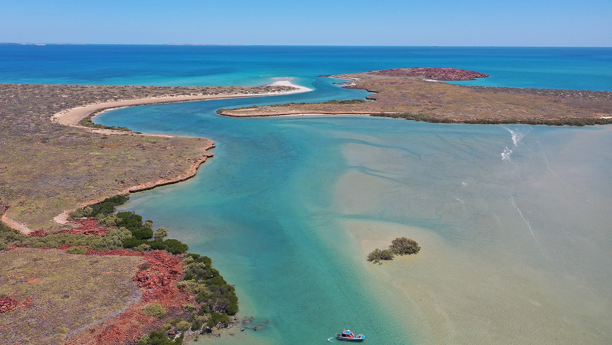
The survey area in the Dampier Archipelago, Western Australia. Credit: Flinders University.
Submerged archaeological sites discovered off Australia’s northwest coast offer a new window into the migrations, lives and cultures of Aboriginal people thousands of years ago, when the continental shelf was dry.
This was a time when around 20 million square kilometres of land was exposed, before the last glacial loosened its grip on the planet and melted ice drowned coastal areas – and large swaths of human history – under the sea.
In Australia alone, two million square kilometres were flooded, hemming back a third of the continent.
“You’re talking about a huge, expansive cultural landscape inhabited by Aboriginal people all over the country… which is just a blank, empty map,” says Jonathan Benjamin from Flinders University, lead author of a paper published in the journal PLoS ONE.
Read the rest of this article...
11,000-year-old mine in underwater cave surprises archaeologists
A diver examines stones stacked into a pile by ancient miners who extracted ocher pigment at La Mina, a site deep inside a cave in Yucatán, Mexico between 10,000 and 12,000 years ago. Rising seas later flooded the cave, preserving the evidence of mining for thousands of years.
PHOTOGRAPH COURTESY CINDAQ.ORG
In the chamber that lay beyond the tiny passage was an ancient scene preserved in stunning detail: an 11,000-year-old mining site for red ocher pigments, complete with tools and fire pits. The mine, described in a new study published today in Science Advances, is one of the few archaeological sites to reveal where and how ancient humans extracted the vibrant pigments that have been put to a host of uses around the world, including mortuary rituals, cave painting, and even sunscreen.
“I’ve spent a lot of time imagining the different ways that people in the past have gone about collecting mineral pigments,” says study author Brandi MacDonald, an archaeologist at the University of Missouri and expert on ocher pigments. “But being able to see it like this in such an interesting state of preservation, it just kind of blew me away.”
Read the rest of this article...
Underwater caves in Mexico preserve one of the world’s oldest ochre mines
A diver examines a rock pile thought to be an ancient navigational marker inside a 12,000-year-old ochre mine in Quintana Roo, Mexico. © CINDAQ.ORG
Now the blood-red rock—a treasured crimson mineral known as ochre—has been found again, this time by underwater divers who were the first people in tens of centuries to return to these now-submerged caves. Scientists have confirmed that the site, now part of a coastal cave system in Quintana Roo, Mexico, is one of the Western Hemisphere’s oldest known ochre mining sites. Ochre, which was used for rock art, body decoration, tanning animal hides, and possibly medicine, was a prize miners would go to great lengths to obtain, from the jungles of Mesoamerica to the grasslands of Africa.
Read the rest of this article...
Tuesday, 23 June 2020
Viking History Is Melting Away in Greenland
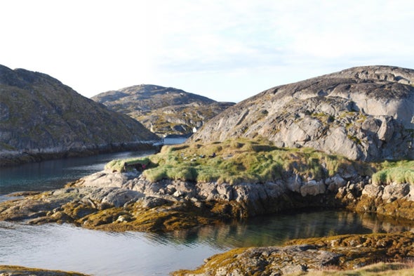
One of the archaeological sites included in the study is located at Kangeq in the archipelago outside of Nuuk in West Greenland. Credit: Jørgen Hollesen National Museum of Denmark
Lining the fjords of Greenland are remnants of Viking-era Norse outposts that flourished for less than 500 years before they were mysteriously abandoned. And now this lost culture is experiencing a second disappearance, triggered by climate change.
Of all the archaeological sites in Greenland, Norse settlements are at the most risk of rotting away as the Arctic warms, according to new research published Thursday in Scientific Reports. The study estimates that up to 70 percent of the organic material in these sites could decay by 2100.
What stands to be lost is a unique record of remarkably preserved material: hair, textiles, human and animal bones, woods, hides, leathers. As the soil warms up and the number of frost-free days increases, microbes attack these fragile organics, leaving only rot behind. The changes are already happening near Greenland’s capital city of Nuuk, says lead study author Jørgen Hollesen, a senior researcher at the National Museum of Denmark. “Here we have some sites where we know that they found a lot of artifacts, a lot of bones, 40 years ago—but today we don’t see that much left,” he says. “There were bones at some point, but now it’s just this fine-grained mush.”
Read the rest of the article
Sunday, 21 June 2020
History in Ice
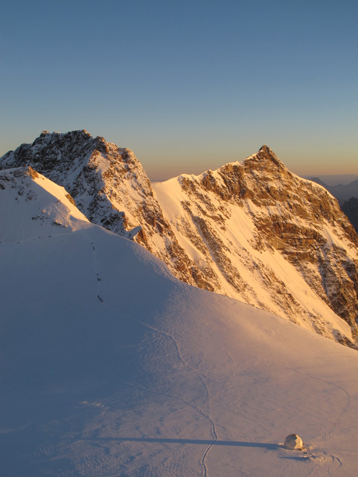
(Dr. Nicole Spaulding, Climate Change Institute, University of Maine)
Colle Gnifetti glacier, Switzerland
Lead pollution levels from the Middle Ages preserved in an ice core taken from Colle Gnifetti glacier in the Swiss Alps reflect political upheaval in England, some 500 miles away, a multidisciplinary research team has found. In addition to studying archaeological data and tax records, the researchers used lasers to measure how lead levels in the core changed from year to year. They observed a major spike in lead pollution during the reign of the English Angevin kings—Henry II, Richard I, and John—between 1154 and 1216, when economic growth led to an increase in silver and lead production from British mines. Lead particles from the extraction and smelting processes were carried southeast by weather patterns, and traces of the metal were trapped in Swiss glaciers.
Read the rest of this article...
Saturday, 13 June 2020
Tree-ring analysis has solved many historical mysteries
Tree rings are now considered to be one of the most revealing of all climatic indicators. Getty Images
Depopulation, pandemics, the rise and fall of empires — all can be explained by dendrochronology, according to Valerie Trouet
History is only as good as its sources. It is limited largely to what has survived of written records, and in prehistory to random fragments unearthed by archaeologists and paleontologists. Climate history is no different. As the effects of global warming accelerate, it becomes ever more urgent to reassemble what we can of the atmospheric conditions of the past to gather evidence from wherever it may be.
Glacial ice cores are one place, with their frozen snapshots of long-ago air and traces of ash and pollen and greenhouse gases such as carbon dioxide or methane. Other climate proxies include the annual accretion of stalagmites, the growth of corals and the incremental layers of bone in the ears of fish. But in recent decades, tree rings have emerged as one of the most precise and revealing of all paleoclimatic indicators.
Each growing season, a tree adds an outer layer of cambium to its core of dead wood. How much is added is a function of thermal and pluvial conditions. The exact width of the ring and its microscopic structure give a very clear picture of the weather during a period of a few warm months, like a postcard from a distant summer.
Subscribe to:
Posts (Atom)